

Table of contents
Woodward Park
Woodward Park in Manoora (not to be confused with the reserve in Mount Sheridan by the same name) is the biggest green space in the suburb (20.4 acres).
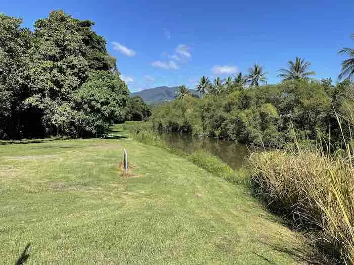
Indeed the park is bordered by Saltwater Creek to the north, Pease Street to the East and Piccone’s Shopping Village to the south.
Woodward Park address
Located on busy Pease Street, this park is readily accessible by public transport users. Indeed Pease Street is accessed by a regular bus service. So this makes it easy to get to for public transport users.
Woodward Park Map
Also Woodward Park is linked to a comprehensive system of shared pathways for the convenience of pedestrians and cyclists.
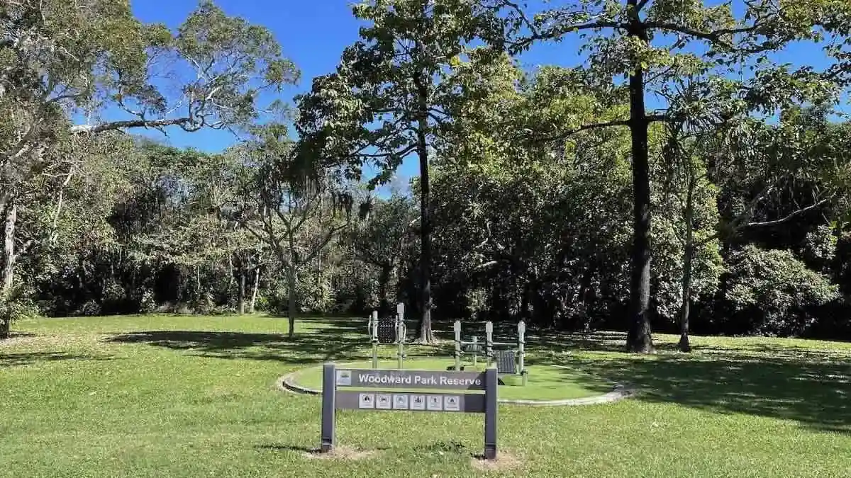
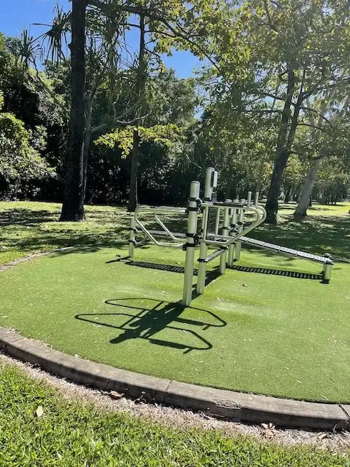
Woodward Park Photos
Over 90 per cent of the park is a heavily forested nature reserve. Much of this is densely vegetated and does not provide easy access to the public.
However, the park has a useable portion that runs parallel to Pease Street. This area is mowed regularly and has some mature trees providing shade as well as council installed exercise equipment.
Woodward Family Cairns
The Woodward Family have been pioneers of the tourism industry in Far north Queensland.
The Woodward Family CaPTA Group was founded by Charles and Pip Woodward who opened Rainforestation Nature Park in 1976 which is located in Kuranda. Indeed Charles and Pip pioneered rainforest tourism with Army Duck Tours and later introduced the Pamagirri Aboriginal Experience and Koala & Wildlife Park.
Later, in 1981, Charles and Pip started Tropic Wings Coach Tours and then expanded significantly during the new millennium adding Australian Butterfly Sanctuary, Wildlife Habitat Port Douglas, Cairns ZOOM & Wildlife Dome and Jungle Tours & Trekking to become the CaPTA Group. Today their three sons, Michael, Ben and Peter are all actively involved in the business.
Woodward Park Maintenance
A mowed headland down the side of the park allows Council staff to perform any maintenance or cleaning work and provides access to Saltwater Creek for any such works required to the creek and its banks.
Woodward Park Scrub
The scrub area of this park includes wet lowlands melaleuca and areas of eucalyptus acacia forest, as well as mangroves along the Saltwater Creek side of the park. Indeed melaleuca forests are often found on depositional plains and along eastern coastal Australia in inundated areas e.g. along watercourses, in dune swales and swamps.

Parts of the scrub in the park are heavily vegetated. However, there are informal trails throughout the park.

Woodward Park City Hours
People use this park at all hours, seven days a week.
Other Council Parks
There are a number of council parks and other green spaces in Cairns West worth a closer look.
Finally, thank you for reading about Woodward Park and if you visit our Cairns Parks, please put any rubbish in the bin.
Comments
One response to “Woodward Park Cairns: 2024 Guide”
[…] Woodward Park […]