


Table of contents
Mulgrave River Cairns
The Mulgrave River south of Cairns is a system incorporating the East Mulgrave River and West Mulgrave, later meeting the Russell at the coast.
The catchment system includes Queensland’s highest mountains, Bellenden Ker and Bartle Frere. In addition this catchment is also Australia’s highest rainfall area.
Mulgrave River Map
There are also more detailed maps of the catchment with accompanying in-depth articles.
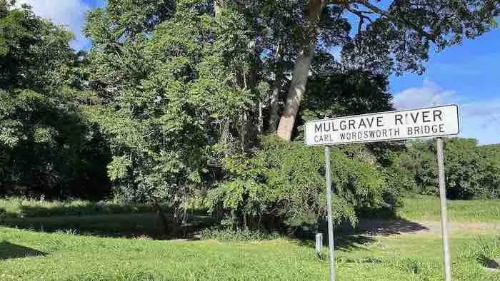
Mulgrave River Bridge
After crossing the highway at Gordonvale at the Desmond Trannore Bridge the river flows east then south. At the southern extremity of the Yarrabah Hills, it meets the Russell River where it empties into the Coral Sea, 70km from the wet tropics.
Mulgrave River Camping
There are a number of camping opportunities along this tropical waterway.
Greenpatch Campground
Leave the Bruce Highway just south of the bridge at Gordonvale. Then simply cross the old bridge and you are at the camping ground.
There is no charge for the use of this facility, so if you are staying at this site please help to keep it clean and tidy.
Little Mulgrave River
The Little Mulgrave is upstream from Ross and Locke. However, unlike Ross and Locke, you are unlikely to be worried by crocodiles in this location.
The river is shallow here (and quite gentle during the dry season), so it is a handy stop to take a refreshing dip. It is also a handy picnic stop with BBQs, picnic benches and tables.
Mulgrave River Fishing
Just before and just after the wet season (October to December and March to April) are probably the best times to fish for Barramundi. People have also caught barramundi, catfish, sooty grunter, spangled perch and yabbies.
Deeral is the closest access point for fishing in the Mulgrave and Russel River estuary and mouth. Turn left into Ross Road just before the petrol station in Deeral. The boat ramp is about 1km down Ross Rd.
As well as fishers, the river and surrounds is popular with hikers, bird watchers and nature lovers in general.
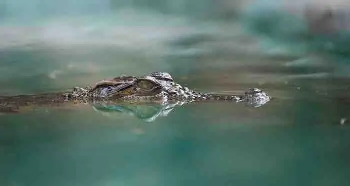
Mulgrave River Crocodiles
Two of the most dangerous critters you will come across in the river are stonefish and crocodiles. Wearing runners while swimming is helpful to protect you from stonefish … however runners won’t help to protect you from crocodiles. Hence it is important to be safe and remember “just because you cannot see a crocodile does not mean there is not one around … waiting.”
Mulgrave River Flooding
The Mulgrave River, located in Far North Queensland, Australia, is prone to flooding, particularly during the wet season. Flooding in this river can have significant impacts on the surrounding communities, agriculture, infrastructure, and ecosystems.
The primary cause of flooding in the Mulgrave River is heavy rainfall during the wet season, which typically runs from November to April. Tropical cyclones and monsoonal rains can lead to substantial increases in river levels.
Community education and preparedness programs are crucial in ensuring residents know how to respond during flood events. This includes emergency planning, understanding evacuation routes, and having necessary supplies on hand.
Maintaining healthy riverine and wetland ecosystems can naturally mitigate flood impacts. Vegetation in riparian zones can slow runoff and reduce erosion, while wetlands can act as natural buffers, absorbing excess water.
Through a combination of advanced monitoring, infrastructure improvements, land use planning, and community preparedness, the region can better cope with the natural hazard of flooding and enhance its resilience to future flood events.
Relevant Material
- Bana Gindarja
- Cairns Creeks
- Chinaman Creek
- Lake Morris
- Lily Creek
- Moody Creek
- Mulgrave River
- Saltwater Creek
- Trinity Inlet
Comments
One response to “Mulgrave River in the Wet Tropics”
[…] is located 23km south of Cairns on the Mulgrave River. However, the town is serviced by buses which have become more reliable over recent […]