

Table of contents
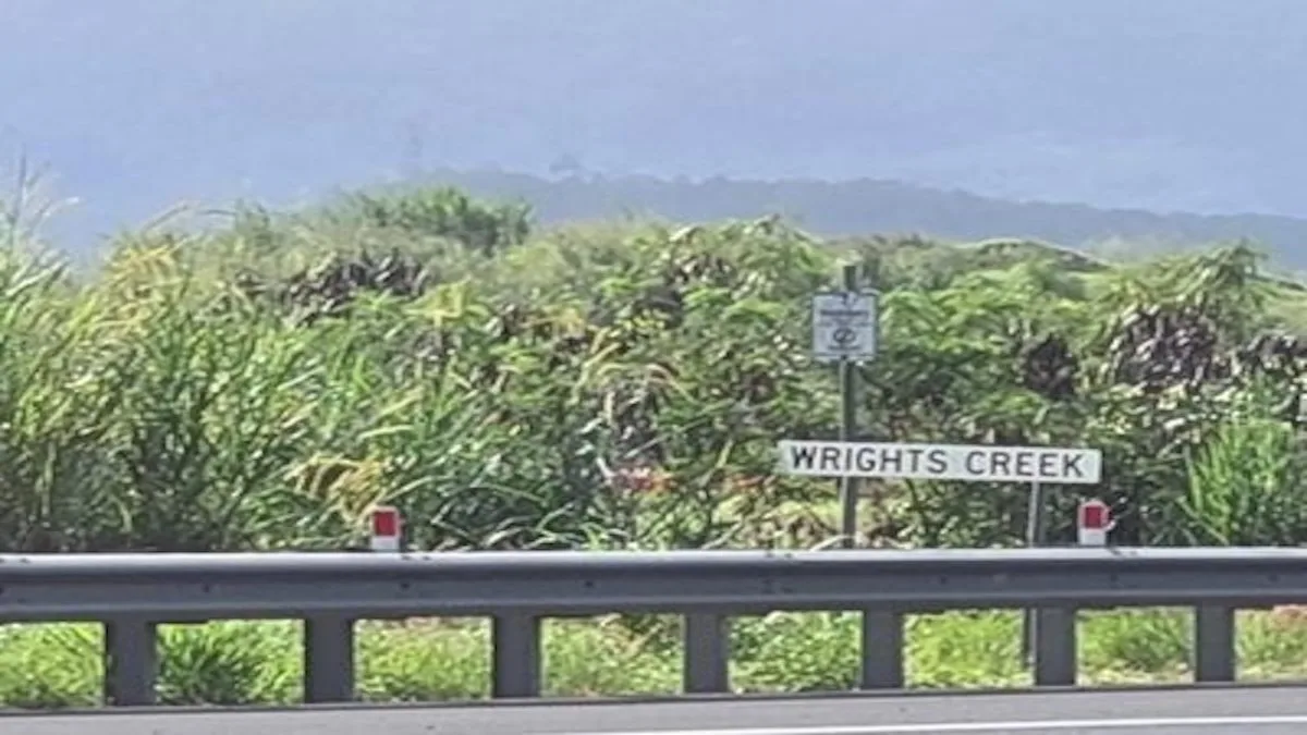
Wrights Creek
Wrights Creek is a locality in tropical Far North Queensland, Australia. Indeed positioned just south of Cairns, it is half way between the towns of Edmonton and Gordonvale.
This area is mostly low-lying land (around 10 metres above sea level) with a small mountainous area to the west of the locality. This mountainous area rises to an unnamed peak, located just west of the Bruce Highway, which reaches 200 metres above sea level.
Wrights Creek Map
Wrights Creek History
The area lies with in the traditional lands of the Yidinji people, the traditional owners of the land.
Following the arrival of Europeans, two brothers, the Wrights brothers, brought cattle to the area in 1878. That is how the area subsequently earned its name.
A Provisional School began classes on 8 October 1894. Subsequently, the school was upgraded in 1909 to a State School. However, it was closed in 1953.
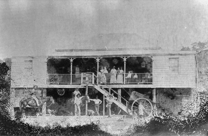
Some of the local families living in the area in the late 1800’s were the Masters, Stephens, Crossland, Collinson, Hill, Hoffman and Pyne. Cane farming became the main land use in the area and family farms dominated the landscape.
The below picture shows a butcher’s cart belonging to Collinson & Mackay. It is at the foot of the stairs of Collinson’s House on the Bruce Highway.
Wrights Creek Things to do
Cycle and Pedestrian Access
Wrights Creek connects to the Cairns Southern Cycleway for those wanting to use a safe off-road cycleway.
Once on the cycleway, users can travel safely ‘off-road’ to Gordonvale in the south, or north to Edmonton and Cairns.
Wrights Creek The Waterway
Wrights Creek (that is the creek not the locality) originates in the Atherton Tablelands. Subsequently, it flows down into the tropical lowlands arriving at Mount Peter and crosses the Bruce Highway just south of Edmonton.
As the creek flows past the highway towards Trinity Inlet it becomes more saline. Recreational users of the creek should be careful, as salt water crocodiles are known to frequent the area. Locals and visitors alike are reminded to be croc safe in croc-country.

Wrights Creek Fishing
The mouth of Redbank Creek and surrounding areas in Trinity Inlet are poplur with fisher. During summer months Barramundi, Mangrove Jack and Fingermark are caught.
Wintertime is the time to fish the gutters and drop offs for Trevally, Queenfish and Grunter. It is good practice to fish deeper water during the slow moving tides and the shallow water on the big fast moving tides.
Wrights Creek Swimming
You can swim upstream where the creek emerges from the foothills. However, you are advised to stay out of downstream sections of the creek
There are crocodiles in this creek. The closer you get to Trinity Inlet, the more likely you are to find one. Please remember to be safe, as these animals can eat you.
Wrights Creek FAQs
The post code for this area is 4869.
The population is around 200 people.
Located in Far North Queensland, the area is located between the towns of Edmonton and Gordonvale.
Packers Camp
Neighbouring Wrights Creek is Packers Camp. To clarify, this locality is bounded by Pine Creek (north); Pine Creek Yarrabah Rd (eastern and south); and Mackey Creek (west). In addition, Simmonds Creek traverses the locality from south to north. All of these creeks become tributaries of Redbank Creek, which flows into Trinity Inlet and then to the Coral Sea at Cairns City.
Indeed the Packers Camp boat ramp is now suited to all tides, featuring four lanes and a floating walkway catering for the local fishing and recreational community. As a consequence of the upgrade, the ramp and floating walkway have improved safety and accessibility through improved boat launching and retrieval operations and provides improved access for pedestrians.
Government
This area lies within Division 1 of the Local Government Municipality of Cairns Regional Council. Consequently, the local Councillor is Cr. Brett Moller, who has represented the area since 2016.
This area is located in the state Electorate of Mulgrave in the Queensland Parliament. Indeed, this electorate was first created in 1950 for the election held that year. However, this century Mulgrave has had only two MPs. Firstly Warren Pitt (1998 to 2009) and then his son Curtis Pitt (2009 to 2022).
Furthermore, this locality is in the Kennedy Electorate, which is held by maverick MP Bob Katter in the Australian Parliament.
Other South Cairns Suburbs
- Bentley Park
- Edmonton
- Gordonvale
- Mount Peter
- Mount Sheridan
- White Rock
- Woree
- Wrights Creek
Comments
6 responses to “Wrights Creek Qld Local Guide 2024”
[…] Wrights Creek […]
[…] Wrights Creek […]
[…] Wrights Creek […]
[…] Wrights Creek […]
[…] Wrights Creek […]
[…] Wrights Creek […]